 Edit
The Strait of Hormuz is closed: is an alternative possible? Ports, railways, and the limits of adaptation
The argument that Iran can offset a Hormuz blockade through overland routes and Caspian Sea ports runs into a fundamental limitation of scale
No volume of railway freight or trucking can substitute for the economic power of deep-water ports, write Zaur Hasanov and Akbar Ahmadov.
Zaur Hasanov is a U.S. based expert on Eurasia connectivity and security. Akbar Ahmadov is a Eurasia logistics expert
In discussions about the Strait of Hormuz, most attention focuses on ship movements and their implications for global commodity markets – particularly oil and gas prices. Iran’s main logistics hub, the Port of Bandar Abbas, is located within the Strait and serves as the country’s primary open-water access to global markets, functioning as a critical maritime gateway for a resource-based economy that relies heavily on the export of oil, gas, and petrochemicals. If the Strait of Hormuz were effectively closed or severely restricted to shipping, exports of oil, petroleum products, and liquefied natural gas from the Persian Gulf region would decline sharply, while Iran’s entire maritime logistics system would also be disrupted, as its key foreign trade hub is tied to the same corridor.
The country’s main port – Bandar Abbas – handles around 50 million tons of cargo and is Iran’s largest container and energy hub. Its container terminal with over 15 berths handles 85-90 percent of all containers arriving in Iran. General cargo terminal is also huge and loads around 50 million tons of cargo on average with over 40 berths.
It is directly connected to the national railway network and accounts for the primary flow of imports and exports. Even accounting for alternative ports, it remains the systemic centre of Iran’s foreign trade.
It is also worth noting that no volume of railway freight or trucking can substitute for the economic power of deep-water ports. Deep-water maritime infrastructure dramatically reduces the unit cost of transportation and expands export geography in ways that overland routes simply cannot replicate – bulk cargo, supertankers, and global routing are functions of the sea, not the rail.
In discussions on this topic, the argument frequently arises that Iran can offset a Hormuz blockade through overland routes and Caspian Sea ports. However, this runs into a fundamental limitation of scale.
There is also a geopolitical dimension to this situation that Iran itself is acutely aware of: if Iran cannot freely use the Strait of Hormuz, it has both the capability and the stated intent to deny that same passage to everyone else. Approximately 20–21% of global oil trade transits through the strait, meaning any sustained closure would deliver serious shocks to global energy markets – particularly for countries heavily dependent on Gulf exports. This threat is not hypothetical; Iranian officials have raised it repeatedly, and it forms a core element of Iran’s strategic deterrence.
Against this backdrop, railway routes become the key instrument of adaptation – but they too face rigid structural constraints, rooted not only in politics but in physical geography.
Iran’s western corridor runs along the Tehran-Tabriz-Salmas line to the Turkish border near Kapıköy. Its annual capacity is only one million ton. From there, the route passes through Van – Tatvan with a ferry crossing of Lake Van, then connects to the Turkish network via Erzurum and Sivas toward Ankara and Europe. This is the most coherent overland corridor, as it operates entirely on standard 1435 mm gauge and requires no transhipment at the border.
The northeastern corridor Tehran-Mashhad-Sarakhs, with capacity of nearly 2 million tons, runs into Turkmenistan, where the post-Soviet railway infrastructure begins with a 1520 mm gauge. This transition necessitates cargo transhipment or bogie exchange. The route continues through Ashgabat and Turkmenbashi toward Uzbekistan and Kazakhstan, forming part of the Eurasian transit network – but with several logistical breaks along the way. It should be noted that Iran is already actively using this eastern direction: trade with China via Central Asian railway infrastructure is ongoing and growing. However, as the structural constraints above make clear, this route cannot serve as a substitute for deep-water port access in the Persian Gulf.
The northwestern Caspian corridor via Tehran-Qazvin-Rasht was intended to serve as a strategic outlet to Azerbaijan and onward to the Caucasus and Europe. However, there is a critical unfinished section – the approximately 160-kilometer Rasht–Astara segment – that has never been built. This means the northern corridor is not a continuous railway line and cannot function as a fully operational transit axis. The geopolitical dimension of this gap is significant: Azerbaijan sits between Iran and Russia along this corridor and effectively controls whether a direct rail connection between the two countries can ever be completed. The finished route would run from Iran through Azerbaijani territory to the Russian border, meaning Baku holds decisive leverage over the corridor’s future. Azerbaijan has its own complex political calculations regarding both Moscow and Tehran and has shown little urgency in facilitating its completion without extracting meaningful concessions.
The port of Anzali, one of Iran’s key Caspian ports, has a throughput capacity of around 7–10 million tons per year, with actual handling volumes considerably below that level. The Caspian port complex as a whole – including Anzali, Noshahr, and Amirabad – operates at a scale that is simply incomparable to the country’s southern ports and physically cannot replace Bandar Abbas in terms of volume.
Beyond capacity figures, the Caspian ports face a deeper structural problem: the Caspian Sea is undergoing severe ecological change and its water level has been falling dramatically in recent decades. As a result, port draft has decreased to the point where vessels on the Caspian are limited to loads of around 5,000 tons. By contrast, ships operating through Persian Gulf deep sea ports routinely handle between 60,000 and 80,000 tons. This is not a logistical gap – it is a physical one, and it cannot be engineered away. The same constraint applies to Russian Caspian ports, making the entire basin a structurally limited transit zone.
For context, the Caspian ports of the broader region – including Turkmenbashi and Baku – have limited container capacity measured in tens of thousands of TEUs, while Iran’s southern maritime system handles millions of tons of cargo annually. This means that even under full mobilisation, the northern direction remains supplementary rather than foundational.
The eastern corridor via Zahedan-Quetta-Lahore provides an outlet toward Pakistan and potentially onward to the China-Pakistan Economic Corridor. However, this route remains both politically and infrastructurally challenging and cannot guarantee stable, high-volume flows.
A separate case is Chabahar, located outside the Strait of Hormuz and representing a strategic alternative maritime outlet for Iran. But even Chabahar is not comparable in scale to Bandar Abbas, and it lacks sufficient railway connectivity to the domestic network to serve as a genuine replacement.
A further structural constraint deserves mention: Iran’s railways, while geographically extensive, are not a primary economic driver of the country and operate well below their potential. This is partly a function of chronic underinvestment – Iran faces significant shortages of locomotives, wagons, and other essential rolling stock, meaning the network cannot be rapidly scaled up even if political and geographic conditions were favourable.
In sum, if the Strait of Hormuz is closed and Iran’s southern maritime logistics are paralysed, the country’s railway corridors and Caspian ports can indeed absorb and redistribute a portion of flows – but they cannot replace the main maritime hub in terms of volume, speed, or cargo composition.
The result is not an alternative, but a system of partial compensation: railways and northern ports can sustain limited supply and external trade, but the core economic weight of the country remains – historically and structurally – anchored to the southern maritime axis through Bandar Abbas and the Strait of Hormuz.
This raises the key question: for how long can Iran maintain a blockade of the Strait of Hormuz while itself being cut off from the main supply routes required to sustain its population of 92 million?
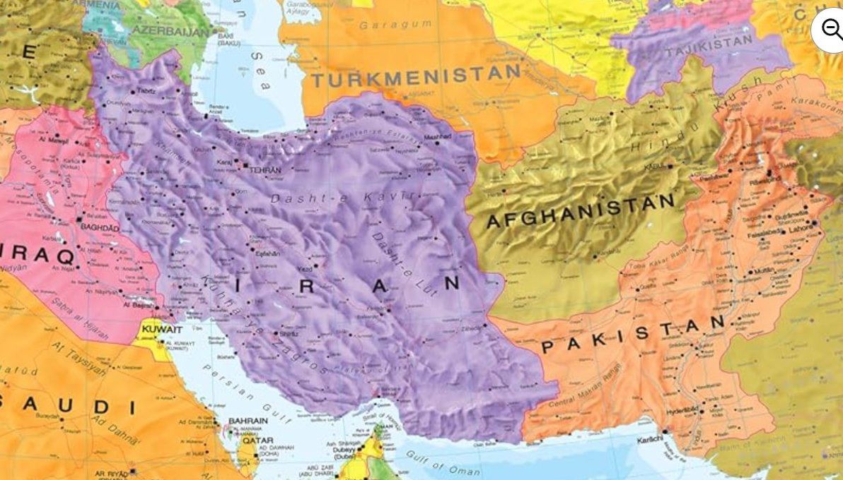
Caption: A screenshot from Maps International, sold online by Amazon
Updated: April 27, 2026 - 11:04